Your recorded stats.
Your layout. Start free.
Create speed, heart-rate, cadence or power overlays from supported recordings. Keep exporting core gauges on Free with no watermark or trial expiry. Export a separate layer, then place it over your footage in a video editor and export the finished video. Available readings depend on what was recorded.
Browser illustration with simulated readings; includes paid styles.
- 30
- gauge kinds
- $0
- ongoing Free
- 0
- watermarks
Reads the data your gear already records
Import supported GPX, FIT or GoPro GPMF recordings. In a multi-source project, choose each gauge’s source and manually align it with your footage.
GoPro GPMF in MP4
Auto-scanned when the original MP4 contains GPMF; available streams depend on the camera and recording.
- GPS location, speed & altitude (GPS5 / GPS9)
- 3-axis accelerometer (ACCL)
- 3-axis gyroscope (GYRO)
FIT activity files
Import a recorded FIT activity exported from Garmin, Wahoo, iGPSPORT or another compatible device. Available fields depend on the recording.
- GPS location, speed & altitude
- Heart rate & temperature
- Cadence & power
- Timestamps & recorded distance
GPX
Import a recorded, timestamped GPX track. A planned route without recording times is not enough to match your video.
- GPS location, speed & altitude
- Date & time
- Heart rate & cadence (when present)
- Power & temperature (when present)
30 gauge kinds,
grouped like the in-app picker.
Free covers core readings such as speed, pace, power and heart rate. Routes and effort zones require Basic; Friction Circle, Lean Angle and Yaw Rate require Premium. Styles vary by gauge and can require a higher plan.
Movement & Position
10 gaugesSpeed, elevation and direction from recorded positions.
Map & Route
4 gaugesRecorded routes and location labels.
Fitness
6 gaugesSupported heart rate, power, cadence and temperature readings.
Motion & IMU
6 gaugesRecorded and calculated motion measurements; available fields depend on the source.
Time
1 gaugeTime from your recording.
Static & Utility
3 gaugesText, images and custom numeric fields.
One field,
several ways to show it.
Choose among the styles offered for your selected gauge. Mini, bars and graphs cover many Free tasks; dial, tape, showcase and effort-zone styles require Basic or Premium. Available choices depend on the gauge.
Mini · Free
A compact value and label for core numeric fields.
Circular · Free
A circular readout for supported numeric gauges.
Completion Bar · Free
Show progress between a minimum and maximum.
Graph vs Time · Free
Plot a supported numeric field over time.
Needle Dial · Basic+
A classic needle readout for supported numeric gauges.
Zone Pills · Basic+
Heart-rate or power zones from the recorded field.
GPS route on a real map — or no tiles at all
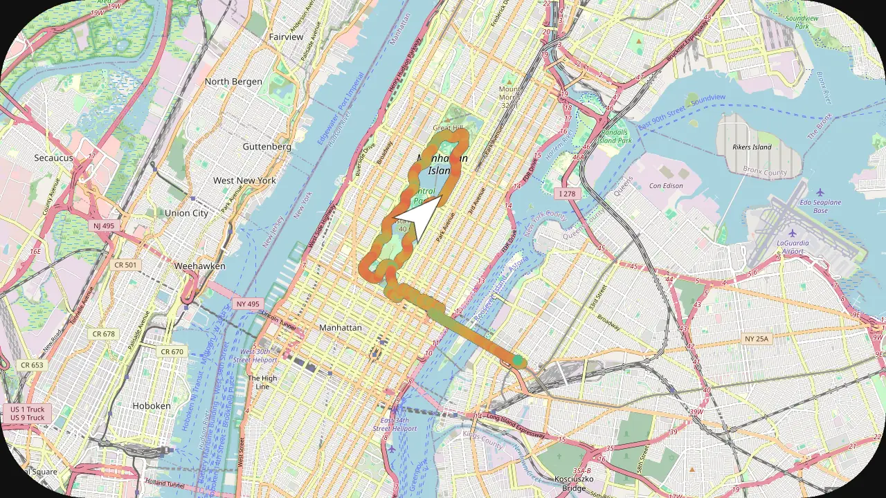
GPS Path, GPS Path + Compass and 3D Route draw your recorded route and a live position marker over a real basemap. OpenStreetMap streets, OSM Dark and OSM Light are built in and free — no API key. Add your own free CARTO key for CARTO Dark or Light, or switch to a tile-free vector route. Tiles load while online and are cached for export. There is no satellite or terrain basemap. The route needs recorded GPS positions; it cannot be recovered from footage alone.
- Free basemaps built in — OSM streets, OSM Dark, OSM Light — no API key
- Optional CARTO Dark / Light basemaps with your own free CARTO API key
- Tile-free vector mode for a fully offline route
- Route gradient-colored by speed or elevation
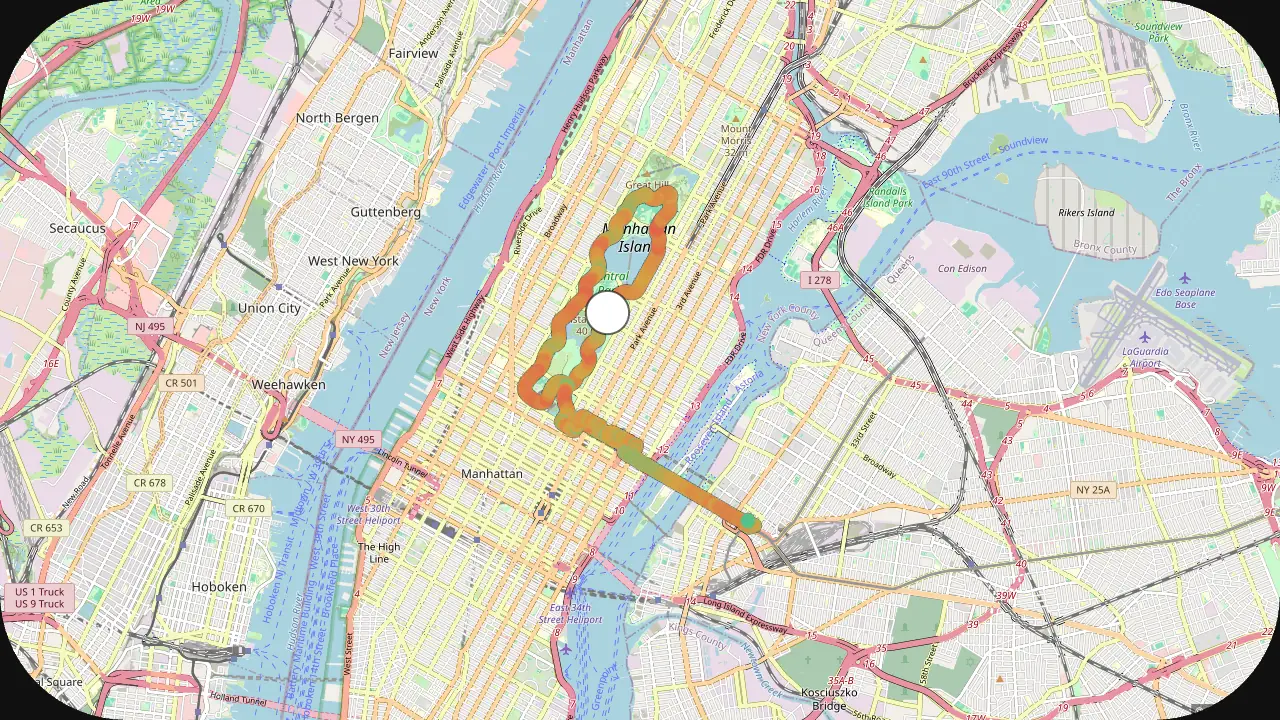
OpenStreetMap
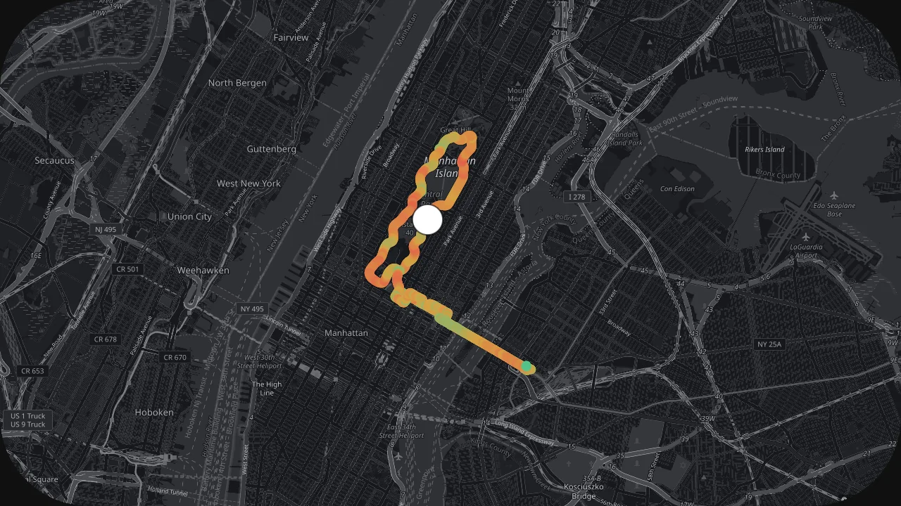
OSM Dark (free)
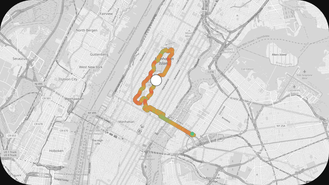
OSM Light (free)
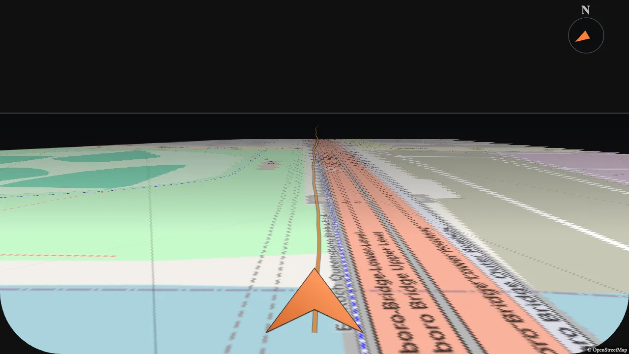
3D Route
GPS Path + Compass
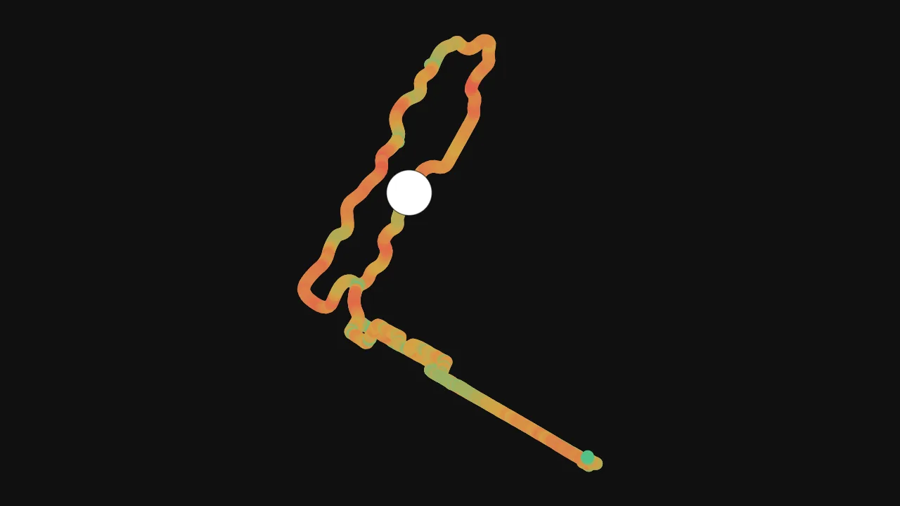
Tile-free vector
Layouts that already know your sport
Start with an activity layout and save your own arrangement. The shown layouts contain paid gauges or styles; those elements require the corresponding plan.
Runner
Pace, distance, heart rate, cadence and elevation.
Walker
Gentler metrics — speed, distance, elevation, route and time.
Cyclist
Speed, power, cadence, heart rate and gradient.
Car / Moto
Speed, g-forces, lean and acceleration when recorded.
A real editor, not a mockup
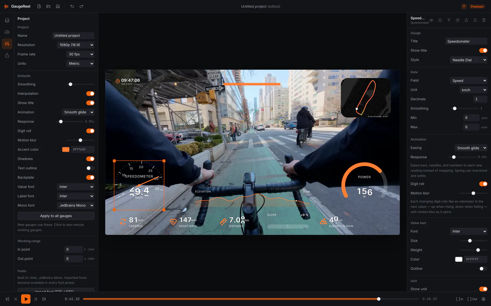
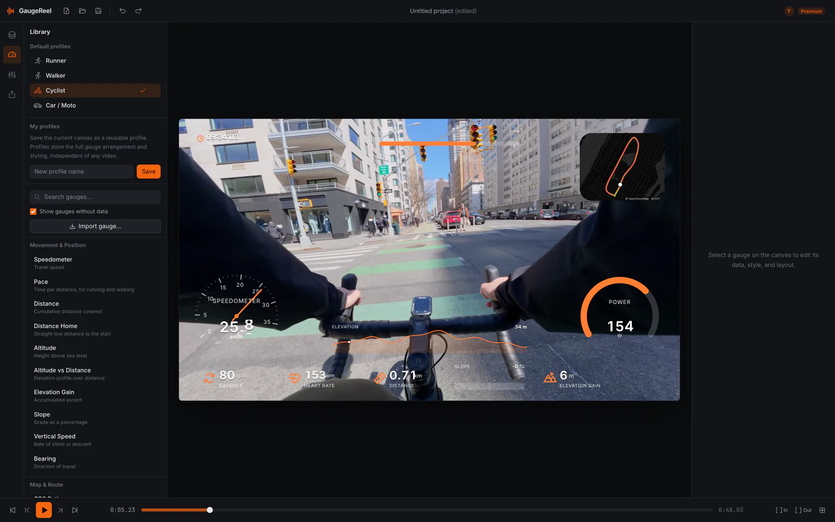
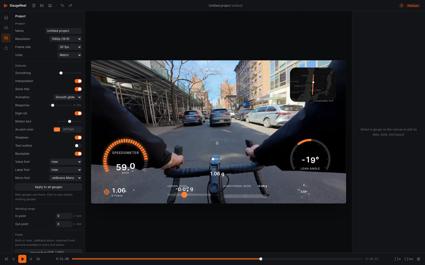
Compose the overlay on a canvas at your true project resolution. The checkerboard is your transparent export — what you scrub is exactly the layer you ship.
Drag, snap & lock
Move gauges with edge, center and grid snapping. Lock, reorder and align on a resolution-true canvas.
Keyframe animation timeline
Animate supported gauge properties with keyframes for intros, reveals and emphasis.
A deep inspector
Bind fields, set units and adjust fonts and sizing on Free. Basic adds colors, icons, bars and backplates; rolling digits require Premium.
Searchable catalogue
Find any gauge by name or stream, grouped exactly as below, with availability filtering by your data.
Transport & grid
Keyboard-driven transport, in/out points, grid guides and safe-area overlays to compose precisely.
Straight onto your DaVinci Resolve timeline
Skip the export-and-reimport round trip. Premium sends the finished overlay directly onto your open DaVinci Resolve timeline — each gauge on its own track, or the whole overlay as a single layer — as ProRes 4444 clips with a real alpha channel that land above your footage. ProRes 4444 file export is also available on Basic; this direct Resolve integration requires Premium.
- Each gauge on its own video track, or one combined overlay layer
- ProRes 4444 clips with a real alpha channel — no chroma key
- Appends above your footage — existing tracks are never overwritten
- Works on free DaVinci Resolve and Studio — no Python, no network
Clean layers.
Free to keep using.
Free includes transparent PNG sequences and MP4 video. Basic adds transparent ProRes 4444 MOV and WebM video. Choose a format supported by your editor, add the layer above your footage and export your finished video.
Available on every plan with supported hardware; export speed depends on your system and project.
Export an image sequence to place over footage in a video editor that supports it.
Free supports MP4 video up to 30 fps, with a maximum width of 1920 and height of 1080.
Make core overlays without a watermark or trial expiry.
Built with Rust and a system webview.
Import recordings from your computer and design your overlay on desktop.
Free: maximum width 1920, height 1080, and video frame rate 30 fps. Basic has the same dimension limits at 60 fps. A 1080 × 1920 portrait layer requires Premium; smaller portrait layers fitting both limits are allowed.
More control over your overlay
Choose the recorded fields, refine the layout and preview the layer before exporting. The details below explain the available controls.
Use the data you already recorded
Import a supported FIT or GPX activity from your watch or bike computer, or GPMF from an original GoPro MP4. Show the speed, heart rate, power and other readings available in your recording.
See your gauges before exporting
Preview your layout over the clip and scrub to check the readings. The preview and export use the same gauge renderer.
Make the numbers easy to read
Move and resize gauges, choose units and adjust their data fields. Start with Free styles; paid plans add more styling controls and designs.
Add your route with Basic
Basic and Premium draw your GPS route over a real map. Free OSM streets, OSM Dark and OSM Light basemaps are built in (no API key), CARTO with your own key, or a tile-free vector route.
Start with an activity layout
Runner, Walker, Cyclist and Car/Moto layouts help you choose useful readings. Some preset gauges and styles require a paid plan; build a Free layout from the included styles.
Keep your own layouts
Save and duplicate profiles so you can reuse the same layout for your next ride, run or walk.
Export on your own computer
Parsing and rendering run locally. Optional hardware encoding is available on every tier; export speed depends on your computer, codec and layout.
Never touches your footage
GaugeReel renders a separate overlay layer. Place it above your footage in an editor that supports the chosen format, then export the finished video there.
Make noisy readings easier to follow
Raw telemetry is noisy. GaugeReel gives every gauge its own treatment so the numbers read smoothly. Smoothing cannot recreate measurements missing from the recording.
Per-gauge smoothing windows
Tune the smoothing window independently for each gauge — a calm altitude readout next to a snappy speedometer.
Interpolation between samples
Values are interpolated between recorded samples so motion stays fluid even when a sensor logs at a low rate.
Sync pipeline
- 01
Find a shared event
Choose a visible start, stop or turn that also appears in the recorded data.
- 02
Adjust the offset
Move that data source earlier or later until the reading matches the video.
- 03
Check later in the clip
If timing drifts, adjust the source stretch and check both ends again.
- 04
Repeat for other sources
Each source has its own alignment; gauges use the source you bind them to.
Works with the cameras you already own
GaugeReel reads GoPro GPMF telemetry when present, and pairs a GPX or Garmin FIT track with footage from DJI, Insta360 and other cameras — so a sports telemetry overlay works with essentially any action camera, 360 camera, drone or phone. 62+ models below, and the list isn’t exhaustive.
GoPro
Reads GoPro GPMF when present in the original MP4. GPS and other streams depend on the model and recording; HERO12 Black has no GPS receiver. Pair a supported, recorded FIT or GPX activity when your footage lacks GPS data. Reframe 360 footage first, then check the data alignment against your clip.
- HERO
- HERO 1 · HERO 2 · HERO 3 · HERO 3+ · HERO 4 · HERO 5 Black · HERO 6 Black · HERO 7 Black · HERO 8 Black · HERO 9 Black · HERO 10 Black · HERO 11 Black · HERO 11 Black Mini · HERO 12 Black · HERO 13 Black · HERO (2024) · LIT HERO
- Session
- HERO 4 Session · HERO 5 Session · HERO Session
- 360
- Fusion · MAX · MAX 2
Insta360
Reframe or stitch in Insta360 Studio, then pair the exported footage with a supported FIT or GPX activity from your bike computer, watch or phone. Studio can also export GPX from supported GPS recordings. Check the data offset against your clip. Native INSV telemetry is not a direct input.
- X / 360
- ONE X · ONE X2 · X3 · X4 · X4 Air · X5
- Ace
- Ace · Ace Pro · Ace Pro 2
- ONE R / RS
- ONE R · ONE RS · ONE RS 1-Inch 360
- GO
- GO · GO 2 · GO 3 · GO 3S · GO Ultra
- Legacy
- ONE · EVO
DJI
Pair exported DJI footage with a supported, recorded FIT or GPX activity from your bike computer, watch or phone, then adjust its timing against the clip. Native DJI GPS-remote metadata and drone SRT, TXT or DAT logs are not direct inputs. These camera models identify footage sources, not telemetry parsers.
- Osmo Action
- Osmo Action · Osmo Action 2 · Osmo Action 3 · Osmo Action 4 · Osmo Action 5 Pro · Osmo Action 6
- 360
- Osmo 360
- Compact
- Osmo Nano
- Osmo Pocket · Osmo Pocket 2 · Osmo Pocket 3 · Osmo Pocket 4
- Drones
- Mavic · Air · Mini · Avata · Avata 2 · DJI FPV · Neo · Flip
Any other camera — pair a GPX or Garmin FIT track exported from Garmin, Wahoo, iGPSPORT, Coros, Suunto, Polar, Apple Watch, Strava, Phone GPS apps and more, then sync it to footage from any camera, phone or drone. Brand names are the property of their respective owners; GaugeReel is an independent overlay tool and is not affiliated with GoPro, Insta360 or DJI.
See it on your own footage.
Free to keep using, with no watermark or trial expiry. No account required for Free exports.